Showing posts with label Bering Strait. Show all posts

A Bering Strait Vessel Traffic Service: Critical Infrastructure for an Opening Arctic (Part II)


by Olin Strader Assuming a VTS is a next logic step in Arctic infrastructure development, alone it cannot be expected to reduce the risks during transit. While a VTS provides the situational awareness by monitoring, tracking and communicating with vessels, it also needs to have a response capability. The Vardø VTS has an emergency tow response service, as well as, two Rescue Coordination Centers in the North and South of Norway.[11] Recall for a moment the Russian Federation’s desire for ten NSR Rescue Centers. But Rescue Centers alone will not be enough to ensure safe passage.

Given the recent environmental catastrophe in the Gulf of Mexico and environmentalists calls for spill response protocols prior to the US Government allowing multinational oil and gas companies to drill in the Arctic, putting appropriate controls in place, to respond in the event of a spill and/or a vessel run aground, would seem reasonable. Fortunately, the Arctic Council appears to be moving toward a Spill Response agreement in the near future. Naturally, as vessel traffic increases, the Bering Strait VTS must also have supporting infrastructure such as aids to navigation, aport facility to harbor emergency tow service vessels and icebreakers, heated hangers and helicopter pads for the Russian Federation Border Guard and/or US Coast Guard air rescue. A strategically placed spill response capability should also be included. All of which would be necessary investments. 

------------------------------------------------------------------------------------------------------------------
Vardø VTS has the following primary tasks:
• Monitor ship movements - record, identify and detect irregularities
• Prevent accidents by maintaining constant dialogue with vessel traffic
• Take action and alert when a situation requires it
• Manage tugboat preparedness Norway
• Monitor the coverage area in the Norwegian economic zone, Svalbard and Jan Mayen
• Navarea 19 coordinator, issuing and sending of navigational warnings
• Assembly and provision of statistics
• 1st line response of the Norwegian Coastal Administration
• Contact in the agreement on international notification of acute pollution with Russia
• Information exchange with Iceland
• National coordinator of Single Hull, reporting to Helsinki Commission/European Maritime Safety Agency
------------------------------------------------------------------------------------------------------------------

Some of the investments necessary to construct the VTS and accompanying infrastructure would require sizable state expenditures by the United States and the Russian Federation. However, the cooperation that would result could make the investments worthwhile, not to mention the jobs created. And if money were the show stopper, the United States and the Russian Federation could require multinational oil and gas corporations and shipping companies to invest some of their capital to pay down their operating risk to safeguard the environment and the eco-system. These monies could then be applied to a Bering Strait VTS and associated infrastructure. But why should Russia and the US do this?


In the 2009 Arctic Marine Shipping Assessment, Arctic Council states in approving the report agreed “to enhance Arctic marine safety, protect the marine environment and expand Arctic marine infrastructure”.[12] Furthermore, in the Tromsø Declaration, the Arctic states noted “that increased marine access and navigation in the Arctic Ocean call for development and implementation of suitable national and international regulations, where appropriate, to advance the safety of Arctic marine shipping, including marine pollution prevention, reduce accident risk and facilitate effective emergency response.”[13] Clearly the recent Arctic Council Search and Rescue Agreement represents a first step in making these pledges reality, but a Bering Strait VTS would constitute a substantial leap forward. So what are the relevant benefits to a Bering Strait VTS?

Internationally, the resulting level of cooperation ensuing from bilateral negotiations between the Russian Ministry of Foreign Affairs and the US State Department could serve to further reset the US-Russian relations. Potentially, the Russian Duma may be encouraged to ratify the US-Russia Maritime Boundary. Environmentalists may be less concerned about the risk of oil and gas spills. The US Coast Guard and the Russian Federation Border Guard could better enforce international and national laws.

Insurance companies like Lloyd’s of London who hold maritime liabilities may be more inclined to reduce shipping companies rates, saving companies who use the NSR the money that can then be reinvested. Alternately, as this international waterway opens to international trade the threats to US and Russian security will increase. Having a national presence at the gateway to the Arctic could mitigate potential criminal or hostile acts and deter illicit activity. Finally, having an International Maritime Organization certified Bering Strait VTS fulfills the pledge made by Arctic nations to enhance Arctic marine safety, to protect the marine environment and expand Arctic marine infrastructure.

This article will be made available in its entirety under the Publications section.

sources:
[10] Barents Observer, “Eyes on the Barents Maritime Safety”, accessed at: http://www.barentsobserver.com/eyes-on-the-barents-maritime-safety.4988868.html
[11] Norwegian Coastal Administration, The Vardø Vessel Traffic Service, accessed at: http://www.kystverket.no/Documents/Om%20Kystverket/Brosjyrer/Vard%C3%B8VTSbrosjyre_EN_HR.pdf
[12] Institute of the North, “Arctic Marine Shipping Assessment”, accessed at: http://www.institutenorth.org/programs/arctic-advocacy-infrastructure/arctic-maritime/arctic-marine-shipping-assessment
[13] ibid. 


A Bering Strait Vessel Traffic Service: Critical Infrastructure for an Opening Arctic (Part I)


by Olin Strader Nations and multi-national corporations are positioning themselves to take full advantage of the Arctic’s Northwest Passage (NWP) and Northern Sea Route (NSR). However, there is every little safety infrastructure in place to ensure incident-free transit. Both of these Sea Lines of Communication terminate in the Bering Strait, the gateway to the Arctic. In this critical water space it is essential the United States and Russia begin considering how to manage traffic through this strategic choke point. 

In September 2011 Prime Minister Putin announced at the second International Arctic Forum in Arkhangelsk, Russia’s “intention to turn the NSR into a key transport route of global importance”. PM Putin further said, “We believe that NSR has a bright future as an international transport artery capable of being a competitor to more traditional routes, both when it comes to price, safety and quality”.[1] Subsequently, Russia has announced it intends to build ten Arctic rescue centers, develop a new Arctic rescue ship, develop military ice-capable transports and construct new icebreakers to replace its aging fleet.

The Arctic, as observers know, is on the verge of historic change and with it mustcome the aids to navigation and safety infrastructure to ensure shipping can be conducted safely and with the reasonable prospect of rescue in the event of a major disaster. No place is more critical to safety in the Arctic than the confined waters of the Bering Strait. Therefore, what is needed is a Bering Strait Vessel Traffic Service (VTS) to mitigate risk associated with increased shipping. The Norwegians have a VTS at Vardø on the northern tip of Norway that could serve as a model for the Bering.[2]

According to the Norwegian Oceanic Vessel Traffic Management Services handbook, the Norwegian Coastal Administration’s missions are fourfold: Coastal Management, Maritime Safety, Maritime Transport and Emergency preparedness in case of acute pollution. Recognizing the Barents Sea is a financially productive water space representing three of Norway’s largest industries: oil, gas and fisheries, it is incumbent on Norway to manage maritime traffic to prevent accidents that could threaten their livelihood.[3] The US and Russian Federation economic zones in the Bering Strait are just as vulnerable as Norway’s.

The Bering Sea is an economic boon for Alaska. According to the State of Alaska’s 2010 State Economic Trends “more than 50 percent of all fish harvested in the U.S. comes from Alaska and accounts for more than 50 percent of basic private-sector employment in many of [Alaska’s] coastal communities”.[4] The Bering Sea is a significant contributor to Alaska’s fishing industry. Meanwhile, shipping and the risk of a maritime disaster is increasing in the Bering Strait with each passing year a VTS is not established.


Reasonable observers would conclude it is high time the United States and the Russian Federation initiate a dialogue on the need for a Bering Strait VTS due to increases in vessel traffic through the Strait during the lengthening summer months and the need to prevent a major shipping disaster. United States Coast Guard figures from 2008 to 2010 show an increase in Bering Strait transits from 245 to 325.[5] However, as the recent Nome gas resupply effort has demonstrated, winter months may no longer preclude Arctic shipping.

Meanwhile, the Russian Federation continues to increase throughput along the NSR.As the Barents Observer reported in late January 2012, “This year’s season on the NSR was special in many ways. Not only was the route accessible about one month longer than usual, but it also had the highest number ever of vessels in transit from Murmansk to another country”.[6] In a more recent Barents Observer article, Gazprom and Sovcomflot´s executives suggested “the relevance of LNG shipping along the NSRto the Asian-Pacific region [is] growing quickly”.[7] Clearly then, the Russian Federation expects to make the NSR a viable option between northern Pacific ports and northern Atlantic ports. There are dissenters who would suggest Arctic shipping will not be as safe and profitable as Russian Federation leaders would suggest. In a recent Insurance Journal article entitled, “Arctic Ice Melt Lifts Hopes for Russian Maritime Trade”, authors Albina Kovalyova & Alissa de Carbonnel opined, “industry analysts and mariners say ice floes, narrow straits, shallow waters, poor infrastructure and stormy winters continue to loom as obstacles to safe and profitable shipping through the polar shortcut”.[8]

Notwithstanding, Russia continues to demonstrate that the NSR is a viable shipping route. Two years ago the Russian Federation announced it would send five vessels of different classes through the NSR as a proof of principle, meeting the mark. They then publicly stated they would increase that number fivefold. This year reportedly 34 vessels transited the NSR. If increases were to continue at current calculations, within five years, however unlikely, transits would exceed over one hundred thousand.

Regardless of how many vessels actually transit the route in coming years, the Russian Federation’s fulfillment of their stated goals should lead observers, and especially policy makers, to believe the NSR will become a major Sea Line of Communication in the not too distant future.

Returning to the topic at hand, there are essentially two types of VTSs, manned and unmanned. The Vardø VTS is manned due to the heavy traffic that transits along Norway’s West coast and the need to safeguard critical state enterprises. Whereas, the few number of ships currently transiting the Bering Strait today may make it feasible to have an unmanned VTS until vessel traffic warrants an upgrade. An unmanned system would likely be monitored remotely both from Russia and the United States, using sensors to track and control Bering Strait traffic. Additionally, a traffic separation plan must be submitted and approved by the International Maritime Organization (IMO). For example, should north bound traffic transit east of Little Diomede Island and southbound traffic transit west of Big Diomede? These are details that must be negotiated between the United States and the Russian Federation.

Clearly gas and oil traffic are expected to increase in the near-term, evidenced by Shell’s CEO Peter Voser’s 31 January Fox Business interview. "For us the focus is in Alaska and to some extent in Greenland, although in the coming years there may also be opportunities in Russia," stated Voser.[9]  Shell is not the only company expecting to 
profit from Arctic oil and gas.  Norway’s Statoil, Total, ExxonMobil and ConocoPhillips are all set to exploit the reported 90 billion barrels of oil, up to 50 trillion cubic meters of natural gas and 44 billion barrels of natural gas liquids that the 2008 US Geological Survey suggests are in the Arctic.  Therefore, it is essential to mitigate the accompanying risk of increased Bering Strait vessel traffic by resourcing a VTS. 

Part II can be found here.

Sources:
[1] Barents Observer, “Putin sees bright future for Arctic transport”, accessed at: http://www.barentsobserver.com/putin-sees-bright-future-for-arctic-transport.4963803-16149.html
[2] Norwegian Coastal Administration, The Vardø Vessel Traffic Service, accessed at: http://www.kystverket.no/Documents/Om%20Kystverket/Brosjyrer/Vard%C3%B8VTSbrosjyre_EN_HR.pdf
[3] The FishSite.com, “Norway Fishery Products Annual Report 2007” accessed at: http://www.thefishsite.com/articles/344/norway-fishery-products-annual-report-2007
[4] Brynn Keith, State Economic Trends: November 2010 (Juneau: Alaska Department of Labor andWorkforce Development, 2010), 3. accessed at: http://labor.alaska.gov/trends/nov10.pdf
[5] Rear Admiral Chris C. Colvin, “USCG District-17 Arctic Brief” (Slide 5), accessed at: http://www.uscg.mil/d17/Arctic%20Overview%20Feb2011.pdf
[6] Barents Observer, “34 vessels in transit on NSR”, accessed at: http://www.barentsobserver.com/34-vessels-in-transit-on-northern-sea-route.4991248.html
[7] Barents Observer, “Testing out LNG on NSR”, accessed at: http://www.barentsobserver.com/testing-out-lng-on-northern-sea-route.5013956-117495.html
[8] Albina Kovalyova and Alissa de Carbonnel, Insurance Journal, “Arctic Ice Melt Lifts Hopes for Russian Maritime Trade”, accessed at: http://www.insurancejournal.com/news/international/2012/01/27/233056.htm
[9] Fox Business, “Shell CEO Says Arctic Focus on Alaska, Greenland”, accessed at: http://www.foxbusiness.com/news/2012/01/31/shell-ceo-says-arctic-focus-on-alaska-greenland/#ixzz1l6aFgR8n
[10] Norwegian Coastal Administration, The Vardø Vessel Traffic Service, accessed at: http://www.kystverket.no/Documents/Om%20Kystverket/Brosjyrer/Vard%C3%B8VTSbrosjyre_EN_HR.pdf


After Period of Slow Melt, Arctic Ice Extent is Again Declining Rapidly


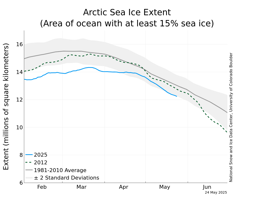
by Malte Humpert With about a month to go before the melt season concludes at the end of September, the Arctic ice cap has begun shrinking at a faster pace again. It now covers the second smallest area ever observed for mid-August.

Satellite imagery released by National Snow and Ice Data Center (NSIDC), showed that ice covered 5.56 million square kilometers on Aug. 14 - about 2.11 million square kilometers below the average for that date, but 220,000 square miles above the record minimum from 2007.

According to NSIDC, "Sea ice is low across almost all of the Arctic, with the exception of some areas of the East Greenland Sea. It is exceptionally low in the Laptev and Kara Sea areas.” 

The Arctic ice cap plays an essential role in stabilizing the world’s climate. The loss of summer-time ice directly contributes to climate change since darker open water absorbs more solar energy than white ice floes. Solar energy is stored in the ocean and thus melting continues even when the solar radiation begins to weaken in September.

Arctic sea ice is highly responsive to a shift in weather patterns. During early summer continued high-pressure across the northern Beaufort Sea accelerated ice loss. By the end of July the weather pattern had shifted and colder temperatures prevailed slowing the ice loss. At the same time, however, strong winds spread out the ice pack resulting in thinner than average ice-coverage. The renewed acceleration of melting can be attributed to the return of high-pressure in the region which results in higher temperatures. 

The question if the 2011 minimum ice extent ends up being slightly above or below the record year of 2007 will depend mostly on the weather patterns over the coming two weeks.

Improved resolution of satellite imagery suggests that 2011 ice extent has been tracking closer to the 2007 record low than earlier measurements suggested. The more sophisticated system used for the latest set of data resolves ice pack down to 6.1 kilometers compared to the previous 24.9 kilometers. Hence the system can detect small but widespread areas of open water that were previously thought to be continuous ice.

New satellite images also show that the Northwest Passage now appears to be free of ice and could theoretically be navigated by ships. On the other side of the Arctic Ocean, the Northern Sea Route (NSR) has been open for shipping traffic since July. The Russian gas producer Novatek plans to send the 120,000-ton tanker Vladimir Tikhonov along the Siberian coast and through the Bering Strait. In total, Novatek plans to ship more than 400,000 tons of gas condensate along the NSR in 2011.

Meanwhile, the National Oceanic and Atmospheric Administration (NOAA) reports, that average temperatures across the globe for the month of July was 61.4 Fahrenheit (16.4 Celsius), about 1 degree Fahrenheit over the 20th century July average. That's the seventh-warmest July since records started being kept in 1880.


July 2011 was the 317th consecutive month with a positive global temperature anomaly. The last month to have a global temperature below its 20th century average was February 1985.